Three Bellevue Parks

BY margaret Laliberte, EASTSIDE HERITAGE CENTER VOLUNTEER

The Vertical File at Eastside Heritage Center is a treasure trove of original miscellany—largely newspaper clippings—organized into hundreds of topics pertaining to Eastside history.  An old-fashioned browse through a manila file is likely to turn up intriguing and unexpected tidbits for those with a love of our local history.  Take the Bellevue Parks files, for example.  Here’s a sample of some little-known and/or long forgotten stories about three Bellevue parks.

Enatai Park’s “Crater.”  The park, at 10661 S.E. 25th St., is a peaceful sanctuary of big left maple and conifers.  But to access the picnic tables and children’s play area the visitor must make a steep descent into what appears to be a deep crater.  How can this be?  An article by local historian Lucile McDonald dated October 23, 1983 (newspaper unknown) solves the mystery.  At the same time that the first floating bridge between Mercer Island and Seattle was being built in the late 1930s, crews were also improving the old roadway leading east to North Bend to create the four-lane Sunset Highway.  The local Lakeside Gravel Company excavated a large gravel deposit on the site of today’s park to provide surfacing material for the new roadway.  Once the quarry was no longer needed, the crater was used for while as a garbage dump until local residents stymied that use.  The property was sold in 1940, and in 1950 the owner sold the property to the City of Bellevue.

Brian Goldbloom’s “Ruin”

McCormick Park’s granite “ruin.”  A familiar sight in the narrow park that runs along the north side of N.E. 12th St. in downtown Bellevue, across from the Belletini residence, is the enigmatic granite construction that some might feel looks like a ruined cathedral.  Its backstory can be found in a June 23, 1989 Journal American editorial.  The sculptor, Brian Goldbloom, created numerous pieces of public art in the Pacific Northwest during that era, working mainly with natural stone materials.  According to the editorial, his vision of this creation was something that would add a sense of the past to Bellevue, which he felt is too young to have a deep sense of time and place.  He also wanted to create something that would, in his words, “draw people in so they’d want to hang around.”  Ironically, the current pandemic created the circumstances that have drawn small groups of two or three locals at a time to sit on the stone pieces of this artwork to socialize.

Bellefields Nature Park, Bellevue American newspaper clipping.

Bellefields Nature Park’s tikis and totem.  The separate identity of this early park has vanished today, merged into the larger Mercer Slough Nature Park. The land for the original Bellefields Nature Park, at the north end of the slough and running between 118th Ave. N.E. and Bellevue Way, was purchased by the City of Bellevue in 1957.  Because of the deep deposits of peat underlying the site, original plans to develop tennis courts and a golf course had to be shelved. As  Lucile McDonald explained in a 1983 article, “the greens would be bouncy,” and costs to develop the area would be prohibitive. So Siegfried Semrau, the city’s park’s director, decided to develop  a “nature park.” Boys from the state’s Youth Corps built a network of trails through the park over four years, earning  $25 a week for their work. A 1969 article in the Bellevue American noted that the park department’s sign maker, Earl “Bud” Baunsgard. “ has created several wood carvings… to surprise the hiker as he strolls along the trails.  Two tikis and a totem pole greet park users with a trio of brightly colored frogs.”

The tikis and totem are long gone, but a “heritage” park sign built by Baunsgard still stands in the city’s Killarney Park.

Resources

Eastside Heritage Center Archives

Sharp Cabin

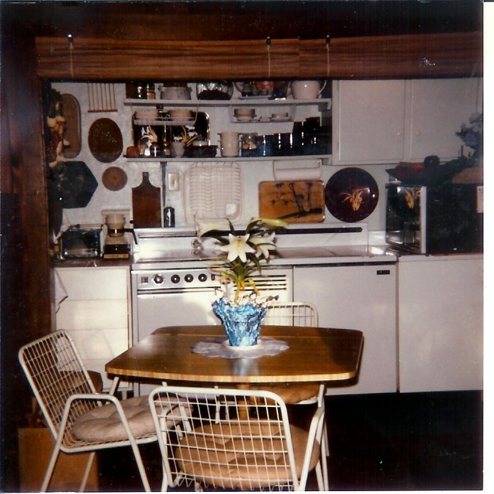
This is the third in the series of “Early Bellevue Cabins”.  The Sharp Cabin (also known as the Sharp Cottage), can be found at the Bellevue Botanical Garden. This structure has also been moved multiple times and has undergone changes to its appearance.

2014.033.073 - Sharp Cabin at Bellevue Botanical Garden

2014.045.003 - The interior of Cottonwood Cabin kitchen, May 1985.

In 1883, James Sharp applied for an 80- acre homestead located near NE 8th and 124th Ave NE in Bellevue.  He built a one- story log cabin on his claim and later built a more permanent dwelling.  Both were on the property when it was sold in 1926 as part of the Cottonwood Hill Plat.  An Armenian-American family, the Davajian’s, eventually settled on the site and remodeled the larger home in 1932.  Three generations lived there until it was sold in January 1952.  Several owners followed and eventually, the wooden stilts under the cabin were removed.  The second floor became the entry just it appears today.

In 1989, the property was sold and scheduled to be developed as townhouses.  Scott Parker was renting the cabin and approached the Bellevue Historical Society and the Bellevue Parks Department about preservation of the dwelling.  It was moved to the Botanical Garden and eventually relocated when the garden was renovated.  It is now used as a meeting room for volunteer groups and staff.

2004.030.003 - Side view of the Sharp Cabin, 1964.

 Please walk around the cabin and observe the carved scrollwork with two eight-pointed stars cut into the wood.  The style of workmanship is rarely found in cabins and perhaps was done by a local craftsman.  John Zweifenhofer, a cabinet maker, lived south of Northup Way, and could have been the mystery builder.  He passed away in 1910 so could have been responsible for the second -floor artistry.

Unfortunately, the cabin is not open to the public, so the inside features must be viewed from the windows. The walls are paneled and at the peak of the gabled ceiling, there is a cluster of three wooden eight-cornered stars. An interpretive sign is located near one of the garden paths.


Resources

Eastside Heritage Center Archives
Mercer Slough Farms

BY Barb williams, EASTSIDE HERITAGE CENTER VOLUNTEER

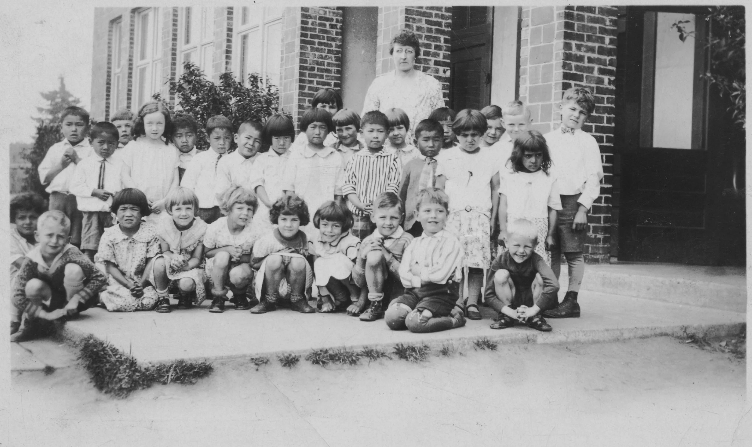
For thousands of years Native Americans gathered the rich harvest of plants and animals along the shores of the Mercer Slough. In 1916 when the Ballard Locks were constructed in Seattle, the water level on the Eastside dropped 9-12 feet exposing dry lands such at those along the Mercer Slough. Farmers moved into the area.

Andrew (3rd from left) and Marc (far left) Balatico with workers in fields, c. 1930

EHC Research Collection, courtesy Balatico family

One of the farmers was Andrew Balatico and his brother, Marceliano.  By 1977 they were the only truck farmers in Bellevue. Customers came from far and near to buy their vegetables. The Balatico’s pumpkin patch was well-known to local residents. As orphans in 1926, the brothers immigrated to the United States from the Philippine Islands. They worked on the railroads then moved to Bellevue in 1930 to work for Japanese farmers. After leasing Newport Hills farmland and hiring Japanese workers, the brothers purchased 23 acres near the Mercer Slough. They dynamited the plow-breaking stumps in the peat marsh and added lime to sweeten the acidic soil before anything would grow. Their farm became successful. However, during World War II they feared they would be drafted. But due to a decree issued by President Roosevelt, they were able to continue farming.  In 1985, Andrew sold his property to the City of Bellevue. Much of the old farm is presently covered by the Light Rail parking garage on Bellevue Way SE and is part of the Mercer Slough Nature Park. He passed away in 2002 at the age of 92.

OR/L 79.79.358 - Cecelia Winters, 1917 with produce.

Other people who came to farm were Cecilia and Frederick Winters. In 1917 they bought ten acres of land just north of the Balatico farm. They built one of the most successful wholesale floral businesses of the time specializing in greenhouse-raised azaleas, daffodils and iris.  Fortunately for the Winters, they had purchased carloads of imported Dutch and Spanish bulbs before a ban on imported bulbs was enforced in 1926 due to the spread of an infectious bulb disease. Their bulb business became highly profitable and they were able to build their lovely home “The Winters House”;  the only building in Bellevue on the National Register of Historic Places. Their home exists today along Bellevue Way SE. The Spanish Eclectic style building was built for $32,000 in 1929 by contractor, Anson Ralph Grosvenor. During this time, Cecelia grew vegetables that she and her sons, Walter and Forrest, sold to summer residents in Beaux Arts. In 1937 the Winters sold part of their estate to Andre Ostbo who raised prize-winning rhododendrons in and around the greenhouses that are partially visible today along the Ostbo Loop boardwalk east of the house. He operated his King of Shrubs business there until the 1970s. In 1943, the house and grounds were sold to Frank and Anna Riepl. The Winters eventually moved to Vashon Island where they established a business specializing in carnations. By 1988 the property had been purchased by the City of Bellevue and included in the Mercer Slough Nature Park.

Bill Pace at Overlake Blueberry Farm. Seattle Times, 2003.

The boggy, acidic soils of the Mercer Slough may not have been ideal for the Balatico and Winters farms, but it was perfect for growing blueberries which have been in the area since 1933. About this time Lee Denison settled on land located between the Balatico and Winters farms. This became the Overlake Blueberry Farm. Denison’s daughter, Mrs. E.L. Van Tine helped develop the business and cultivate the fields. Since then there have been changes. Nancy Harding operated the farm for 14 years until her lease ran out and the City of Bellevue wanted to keep the blueberries while preserving the natural environment and opening the Mercer Slough Nature Park to the public. Bill Pace, Bellevue resident and owner of Bill Pace Fruit and Produce, leased the farm in 2002 which he successfully managed until he was forced out by the Light Rail operation that presently runs through the property. The public has enjoyed fresh produce and “U” pick blueberries at the Overlake Blueberry Farm for over fifty years. The farm still exists and will most likely continue to be managed by the City of Bellevue.


Sources:

Eastside Heritage Center Archives

Books:

Eastside Heritage Center,  Lake Washington The East Side

Lucile McDonald,  Bellevue Its First 100 Years

How to Preserve the End of an Era?

By Steve Williams, EASTSIDE HERITAGE CENTER VOLUNTEER

At the end of Lakemont Boulevard in south Bellevue sits a red two horse barn, five acres of pasture grasses, and the last coal miner dwelling of the 1920's town of Newcastle. For over 100 years coal was dug out of Cougar Mountain and shipped to San Franscisco, turning Seattle into a major seaport by 1880. Seattle's population then was 3,533; but Newcastle by 1918 had well over 1,000 people living right here at Coal Creek. Note the Company Store, Hotel, and Finnish miner's homes on both sides of Lakemont Boulevard in the photo below. Today the road is in the same place, but it is no longer a dirt track with transport only by horse wagons.  

Photo courtesy of Ruth Swanson Parrott, c. NHS

The last coal miner in the area, Milt Swanson, lived in company house #180 there at the end of Lakemont Boulevard opposite the barn. He worked for the B & R Co. until the end of mining in 1963. For the next 30 years he hosted hikers and school groups in a little museum he established in a renovated chicken shed out behind the house. Milt had maps and tools and stories of work in the tunnels and shafts under everyone's feet. He also founded the Newcastle Historical Society and served as its President for many years. (The new 3rd City of Newcastle made him “Citizen of the Year” in 2008). He and his brother John provided tools and artifacts and stories at 15 events sponsored by the Issaquah Alps Trails Club across the street at the Red Town Trailhead.

The “Return to Newcastle” event happened on the first Sunday in June each year. It was a re-union for the miners and their families, and a chance for the trail club to introduce new residents to the woods and local trails. With help from Harvey Manning and others, those events led directly to saving Coal Creek and Cougar Mountain and turning them into public parks that are wildly popular today. Parking lots are jammed on weekends and sunny afternoons. Trails and fresh air have always been enjoyed by people; but nature and exercise have become really important to all of us in these times of Covid. 

Photo by Bob Cerelli, c. NHS

Photo by Steve Williams, c. EHC

Today that historic house #180 property is owned by an outfit called Isola Homes and they are applying for permits to bulldoze it all flat and wedge 35 private houses in there between the two parks. Local citizens began a movement called “Save Coal Creek” to instead preserve the property as a wildlife crossing, a safer hiker crossing, meadow habitat, and perhaps add some trailhead parking while preserving historic features like the barn. If you enjoyed seeing the coal car in the front yard, the open pasture, and one of the last barns in South Bellevue – the question is “Will Bellevue sacrifice it all for just 35 exclusive and expensive private homes?” A public hearing is anticipated in the spring. Visit www.savecoalcreek.org  for updates and more detailed information.


Resources:

“The Coals of Newcastle – A Hundred Years of Hidden History” 2020 edition, the Newcastle Historical Society, ( availble on amazon.com )

“Newcastle” files 183-194, Richard McDonald Collection, the Eastside Heritage Center

“Newcastle's Busy Mining Years” - Seattle Times article, L. McDonald, 10/04/1959

“Seattle in the 1880's” - D. Buerge, 1986 Historical Society of Seattle & King County

“14 Shorter Trail Walks in and around Newcastle” - E. Lundahl, 2018

Recorded Sound

The French inventor Édouard-Léon Scott de Martinville created the first sound recording in history in 1857. It was a rendition of the folksong "Au clair de la lune," captured by Scott's trademark invention—the phonautograph. Recordings made with the phonautograph were intended to be visual representations of the sound.

Thomas Edison's phonograph was the first to invent a device that could both record and reproduce sound. Edison's early phonographs recorded onto a thin sheet of metal which was temporarily wrapped around a  grooved cylinder.

The use of a flat recording surface instead of a cylindrical one was an obvious alternative and the oldest surviving example is a copper electrotype of a recording cut into a wax disc in 1881. In 1931, RCA Victor launched the first commercially available vinyl long-playing record.

Below you’ll find some examples from our collection.


Edison Blue Amberol Record Cylinder. (2014.005.078.A-F)

The Blue Amberol was introduced in 1912 and would be the last incarnation of the cylinder line for the Edison Company. Edison Blue Amberols had a playing time of around four minutes and were marketed as a more durable alternative to wax.

The cylinders featured everything from popular music and band selections to concert and operatic music. This cylinder contains lessons on dictation elocution.


 Bubble Book (97.8.37)

Created in 1917,” the “Bubble Book” was one of the first products to combine the world of book publishing with the new recording industry.

Three of the book’s pages doubled as record sleeves and each of these sleeves contained a miniaturized record, which sang aloud the printed nursery rhymes.


Resources

Eastside Heritage Center Archives

Dumas, Pierre Stephane. “A Brief History of Recorded Music - Part 1.” Medium, The Serenader Project, 8 Jan. 2022, https://medium.com/the-serenader-project/a-brief-history-of-recorded-music-c1b782daac79.

O'Dell, Cary. The First “Bubble Book” (1917) - Library of Congress. 2003, https://www.loc.gov/static/programs/national-recording-preservation-board/documents/BUBBLE%20BOOK.pdf.

“Phonograph.” Wikipedia, Wikimedia Foundation, 13 Dec. 2021, https://en.wikipedia.org/wiki/Phonograph.

University of California, Santa Barbara. Library. Department of Special Collections. “Cylinder Preservation and Digitization Project.” Index, University of California, Santa Barbara. Library. Department of Special Collections., 16 Nov. 2005, https://cylinders.library.ucsb.edu/history-blueamberol.php.